

Introduction
Site list (GPS fixes) Walks (GPS tracks) Video clips Panoramas
Electronic projects:
Bat detector
Lamp tests
µ-controlled lamp
SEPIC-based lamp
ISP isolators
Making SMT boards
Expedition logs:
Spain 1973, 1974,
1975, 1976, 1977,
1979, 1982, 1983,
1985, 1986, 1987,
1988, 1989, 2000,
2001, 2002, 2003,
2004, 2005, 2006,
2007, 2008, 2009,
2010, 2011, 2012,
2013, 2014, 2015,
2016, 2017, 2018,
2019, 2020, 2021,
2022, 2023
Mexico
New England
Translation:
Expedition log, Summer 2002
A summary and index of the Speleogroup logbook.
El Mazuco, Purón/Pruneda, hikes, General Strike, Cabañuca, etc.
| Date | Activity |
|---|---|
| 13.06 | Thursday. Flight on time and we were on the road at 14:30 and arrived at the Hostal Vista Alegre just half an hour later.
Over a tinto in the hotel bar we perused the 1:25,000 map and identified
some new depressions to drive/walk to.
We took the autopista back east and turned off at Santullán and up a forest track to a large depression some 50m deep, on the south flank of Peña de Otañes, used to dump lime spoil. The depression was frequented by giant birds identified by Mike as vultures and by Bill as turkeys or ostriches. Mike’s guess turned out to be right because
 Cow shelter We drove the car down the track below the depression but no sign of any resurgence was found (some fossil resurgence remnants were found at the limestone boundary). Back to Castro for a walk-around and dinner – at least three menús had chuletillas. |
| 14.06 | The long drive west, heading inland at Cabezón de la Sal to Puentenansa. Looked at nearby depression behind Pedreo – but full of fields so descent deemed unnecessary. North from Puentenansa – through road works – to find the road closed, fortunately just where we had already decided to leave the main road anyway and turn off west.
Over the hill to Toyu, looking at one long depression then exploring
a higher one; some flood debris, but no cave.
Stopped at Toyu for a picture of the sign, then south and west to La Hermida for lunch. “Authentic” axed chicken and seafood paella followed by bacon chops.
 The bend in the road Beyond the village of Roza the road deteriorates to a track. Bill scraped the underside of the car a few times but progress was OK for 1 km until deep gullies in the road eventually forced us to park the car at the ‘bend’ in the road (15:30, altitude c.580m). A hot slog in the sun along the easy track of some 3km took us to the “saddle” and an enormous closed valley which should feed La Honda del Val Major. We completed the climb of ~500m in 90 minutes (17:00 1070m). We investigated a few depressions but it doesn’t look too promising.
 Paddock above Roza Eventually back to La Hermida for a tinto and on back to Llanes, just in time for dinner. |
| 15.06 | We had been told in 2001 that in very dry weather the upstream section of Cueva de Caldueñín is passable. Evidently the weather was not very dry and a sizeable river was met as usual. However, we did explore some 20m of new (to us) passage – probably a fossil inlet?
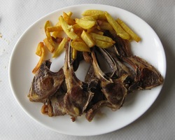
 El Mazuco village Lunch in the El Mazuco bar/restaurant. A very abundant fabada for Bill and chuletillas for Mike, the latter cooked on the open grill [see photo from a later visit]. Checked out numerous side roads and holes on the way back to Llanes; met Sr. Ruiz-Sanchez in Villa and promised a photo. |
| 16.06 | East to the Purón valley, psyched-up for a long trudge up the hill. However, we were delighted to find the old very rough track is now surfaced.
 Pruneda deep pool Next into the ‘wet’ entrance (where the stream enters); we followed the stream to the confluence with an inlet and then explored the extensive series (previously largely ignored) inside of the deep pool previously seen from the other entrance. Tufa and an easy climb to the right led down over dry rimstone pools to series of grottoes with some very nice stals. Total vertical range at least 15 m and at least 50 m distance – all new to us. We returned to the confluence and followed the main stream passage down until it got too wet. Mike, for experiment, used a single-LED PhotonLight “key-fob” light to exit the cave; very successful.
 The track to Pruneda |
| 17.06 | After a trip to the bookshop to search for new maps, we found we had a gap in the Ribadesella quadrant, so decided to head west of Ribadesella to look at Cueva Rosa and its depression. Very foggy along the coast. First stop at El Carmen to look for Cueva Pedroses. After walking around a soggy orchard in the fog for a while, we eventually decided an 80 cm wall was an insuperable obstacle and returned to the car.
Cueva Rosa proved equally elusive in the fog. A direct approach from El Carmen was foiled by a mismatch between map and road, with no chance of getting bearings due to the fog. We then circled north to approach the depression from the west, only to find the farmer at La Teyes had stretched a wire across the road to prevent access. We continued around the south rim looking for routes down the 150 m depression, without success – although we did eventually complete the circumnavigation of the depression and get back to El Carmen. By now it was lunchtime, so into Ribadesella for a pleasant lunch at Mesón Miño (fabada, escalope, etc., €8 each). Despite the lack for 1:25,000 maps, we decided to look for possible tracks leading to Cueva Negra (above Tinganón). First try, from Santillanes, got a little way up the hill (to mill) but still a long walk, so we went around the mountains east to Nueva then up to Llamigo. Around Llamigo the sun came through the clouds and by the time we reached the pass the views were excellent. After a quick check of Riensena, we returned to Llamigo and tried various tracks to the north, which proved non-drivable.
 Tracks and tractor towards Negra From the saddle we were entertained by the sight of a tractor towing a trailor and leading a horse and a dog. The path we were on turned into a Llangattock-like grassy shelf, which took us round and north to the join of the Tinganón valley with the line of depressions to the east. Turning east up through the woods brought us to the line of depressions – investigation found a 10m ‘crack’ through trip, but not much more. By now, fog had begun to drop over the ridge to the north, so we climbed to the right (to +470m) to a fine saddle with gnarled pine trees from where we could see down to the depressions on one side and the tracks on the other. Very fine views. A cattle track to the right brought us to a classic ridge descent to the lower saddle, then circled back to the car just before fog and mist descended. Back via Posada to Llanes. El Retiro for dinner. |
| 18.06 | Bill was editing the OUCC 1970 report » on his PC (CRG) and noticed mention of a resurgence cave near La Roxia bar, in La Pereda. Unexplored! However we decided to press on inland to Fuente Dé rather than stay near the coast where bad weather was expected. (We also considered looking at and araound Pozo del Fresno.)
 Fuente Dé cable car After a long day’s driving arrived back in Llanes to find that it was raining (as expected). Very quiet evening with dinner at Siete Puertas, which opened for the season on Saturday. |
| 19.06 | A wet day. Took the long way round to La Pareda to look for the resurgence reported by OUCC as “near the Bar Roxia”. Unable to find the bar (or any locals foolish enough to be out in the rain, to ask), we checked various roads and then abandoned the search and went on to Posada for Bill’s dental checkup. Then to Ribadesella for lunch (market day). Still wet, so head inland to Arenas in hope of better weather and to reconnoitre some more possibilities.
 Drive-in caving |
| 20.06 | The day of the Spanish General Strike.
Wet and gloomy. Hotel locked down: breakfast with lights off and
curtains closed so no one could see the staff working. Everything
(except the duty pharmacy) in Llanes is closed, including all the
bars and restaurants.
Off to El Mazuco to prospect the saddle beyond Pozu de Fresno. Much wet and soggy walking later, we return to the village – its bar, too, is closed for the strike. The men of the village are standing around in the square, talking seriously. Back down to the coast to hunt for food; finally find a camping bar open at El Brao – no hot food, but at least a rather stale Bocadillo de Queso was to be had. Thus refuelled, we returned to La Pareda where after asking a local we finally found the La Roxia bar (closed of course!). We followed various tracks around but no hint of the fabled resurgence/cave. Back to Llanes, where come evening all was still closed except Antonio’s Pizzaría, Sabor Latino. Only one of his staff had turned up, and the bar was packed, so it took 3 hours to be served – Bill had a pizza and Mike had fajitas – but better than no food at all... |
| 21.06 | The sun is out and the town is open! Inland to Arenas, stop to buy maps (but they didn’t have the Cabrales one!) etc. Then the north-east loop via Alles. Unpromising tracks were still 300m below the limestone wall when they became unpassable.  Saddle en route to Oceño Lunch in Arenas (truchas, fabada), then back to Llanes where Mike takes a 3-hour long walk east along the cliffs to Cue and Ballota to look at the blowholes and sea caves, and to take pictures of Castro Ballota. Dinner (chuletillas) in Uría. |
| 22.06 | Saturday; a sunny/hazy day so we were committed to a last day of caving! Took “inland” route via La Borbolla towards Panes with Mike mapreading along the curvy country road. The map showed a big depression above Andinas; a tell-tale stream stimulated us to drive up a track and then walk to within sight of a sizeable resurgence in woodland. This is probably only a minor system with a major complex higher under the main saddle. Need to revisit.
 Cabañuca entrance The bypass on the left was not initially found. On the right were multiple bolts, for ladders, probably. We needed that bypass! ... and scrambled around for some time. A major inlet leading up on the left seemed an unlikely bypass to a 10 m pitch down the streamway. But Mike found the well-worn passage and Bill proceeded to the 3+ m pitch. Quite vertical! Not really feasible with our equipment. Never mind; it was an enjoyable trip. Next time bring a ladder or full SRT gear. Late lunch in Panes (fabada and lomo for Bill, paella and truchas for Mike) – €9 each. Spent what remained of the afternoon driving to Castro Urdiales, dined well and had an early night. |
| 23.06 | Rain. Quiet drive to the airport in 35 minutes. Few Spaniards to be seen, on the morning after they were knocked out of the World Cup by S. Korea. Uneventful flights back to the UK for Bill & Mike. Mike’s caving gear arrives on the same flight as he does for the first time in 3 years! |
Personnel: Bill Collis & Mike Cowlishaw.
Other log details:
Exchange rate: 65p = 1 Euro = 166 pesetas (255 pts/GBP).
Speleogroup organizational matters:
- decide to set up Speleogroup.org website
- LED investigations – Bill
- GPS investigations – Mike
- Light reconnaisance vs. full caving expeditions? perhaps alternating?
- Hotel investigations for following year should be planned into schedule
- Casto U. only on return, now roads are better?